Search Lethbridge.ca

Regional Planning

Intermunicipal Development Plan

The Intermunicipal Development Plan (IDP) was adopted by the City of Lethbridge and Lethbridge County municipal councils in October 2016. It provides a framework for the long range planning for lands of mutual interest.

The IDP helps to ensure:

  • Land use conflicts across municipal borders are minimized
  • Opportunities for collaboration and communication are provided
  • Processes are in place for the resolution of issues that may arise within the plan area

The City of Lethbridge and Lethbridge County share more than 50 kilometres of border. The activities of each municipality are inextricably linked and affect one another.

Both municipalities are committed to working together to enhance cooperation and achieve coordination wherever possible so that the effects that we have on one another and our residents is positive.

For more information about the IDP, contact Maureen Gaehring, Community Planning Manager:

Intermunicipal Collaboration Framework

The City of Lethbridge and Lethbridge County Intermunicipal Collaboration Framework (ICF) was adopted in 2020.

The ICF provides a framework for how the two municipalities will work together to:

  • Provide for the integrated and strategic planning, delivery and funding of intermunicipal services
  • Steward scarce resources efficiently in providing local services
  • Ensure they contribute funding to services that benefit their residents

South Saskatchewan Regional Plan

The South Saskatchewan Regional Plan (SSRP) is an output of the Province's Land Use Framework. It covers land within the South Saskatchewan River Basin, including Calgary, Lethbridge, Medicine Hat, Airdrie and Brooks.

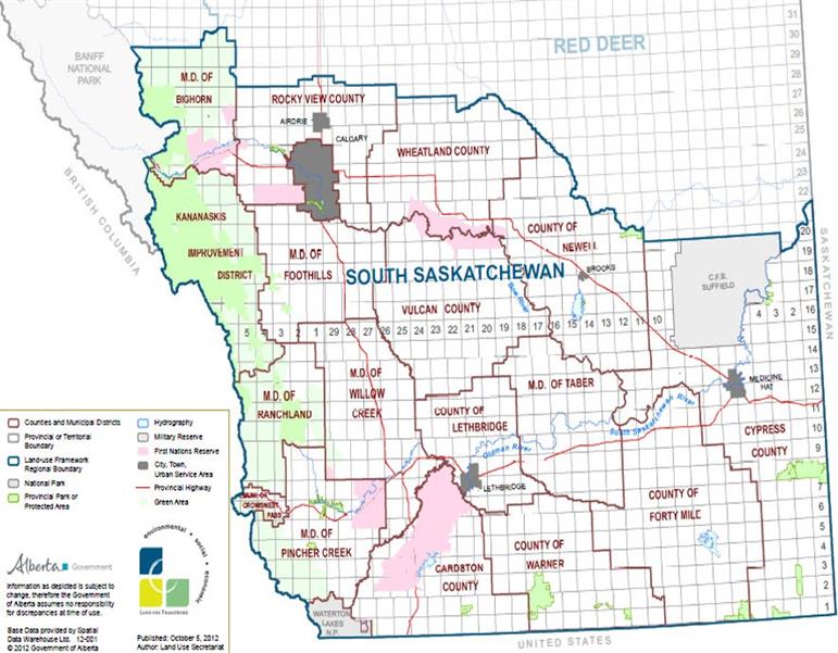
In September 2014, the SSRP, became the second Regional Plan to be adopted by the Government of Alberta. The SSRP applies to roughly 84,000 square kilometers of southern Alberta and incorporates 84 municipalities and First Nations and nearly two million people. 

The SSRP outlines environmental, economic and social values and outcomes for this region of the province in line with the Land Use Framework. This framework is a provincial level strategy document designed to reduce conflict between competing demands for our land and resources.

All land use planners and decision-makers within the South Saskatchewan region, including at the City of Lethbridge, are required to demonstrate compliance with the strategic vision and outcomes of the SSRP when carrying out their normal functions and duties. They must review their planning and policy instruments to ensure they comply with this Regional Plan, and submit a Statutory Declaration that confirms this to the Province.

Planning & Design completed a series of data gathering and analysis projects in 2019, called the SSRP Compliance Initiative. This project involved a comprehensive review of our planning and policy instruments and a declaration that they are complaint with the SSRP. It helped the City understand what the vision of the SSRP means for Lethbridge and informed the creation of the Municipal Development Plan (MDP) in 2021.

SSRP Map

To ensure compliance with the SSRP, the City of Lethbridge undertook a series of data gathering and analysis projects, which are listed below:

Economy and Tourism Inventory

Relationship Inventory

Environmental and Historic Resources Strategy

Lethbridge Heritage Survey

Traditional Knowledge and Land Use Assessment

Traditional Knowledge and Land Use Assessment (Video)

Efficient Land Use Strategy

The City of Lethbridge submitted the Statutory Declaration confirming our compliance with the SSRP to the Province of Alberta in 2019.